Learn about how you can customize your map and trail experience on the RIDE COMMAND website and Polaris App for the App Store® and Google Play®.
Switching Between Off-Road and Snowmobile Trails
App
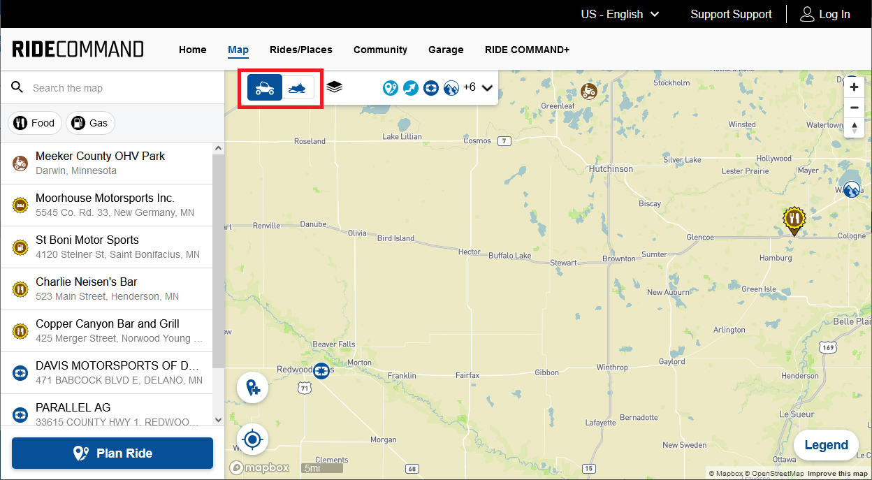
To change between Off-Road trails and Snowmobile trails, select the Off-Road Vehicle (left) or Snowmobile (right) icon in the upper-right-hand corner of your screen, as shown below.
![]()
When this is selected, you can toggle back and forth between Off-Road and Snowmobile trails.

Web
Legends
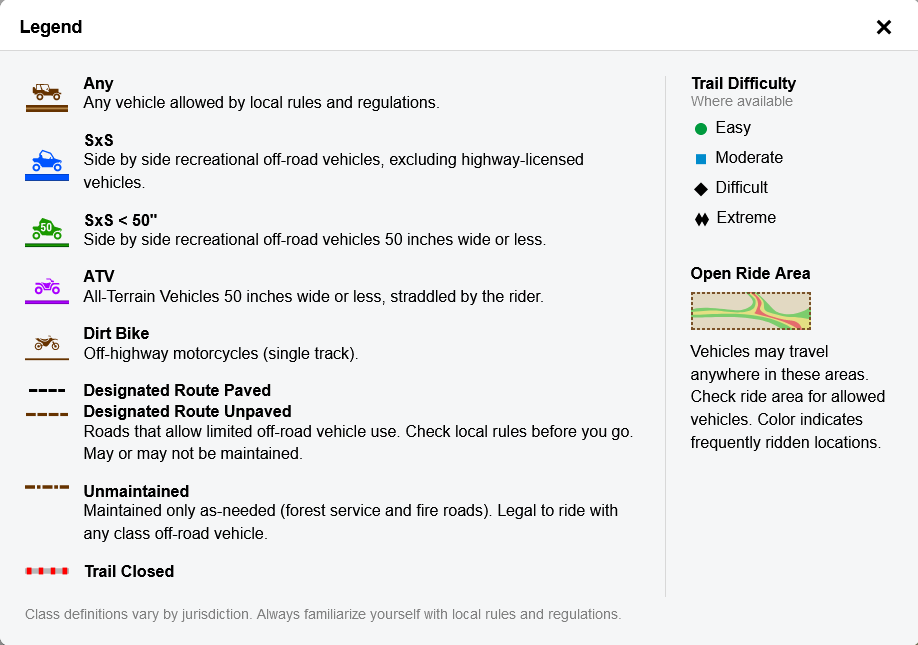
For Off-Road Vehicles, be sure to pay attention to the trail type to see if your vehicle is permitted for use on the trail.
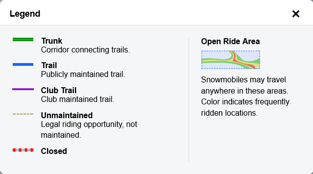
Each trail color corresponds to a type of trail. The legend below shows snowmobile trail classifications.
Map Options
Open these options on the website by clicking the arrow.
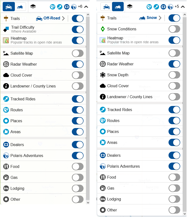
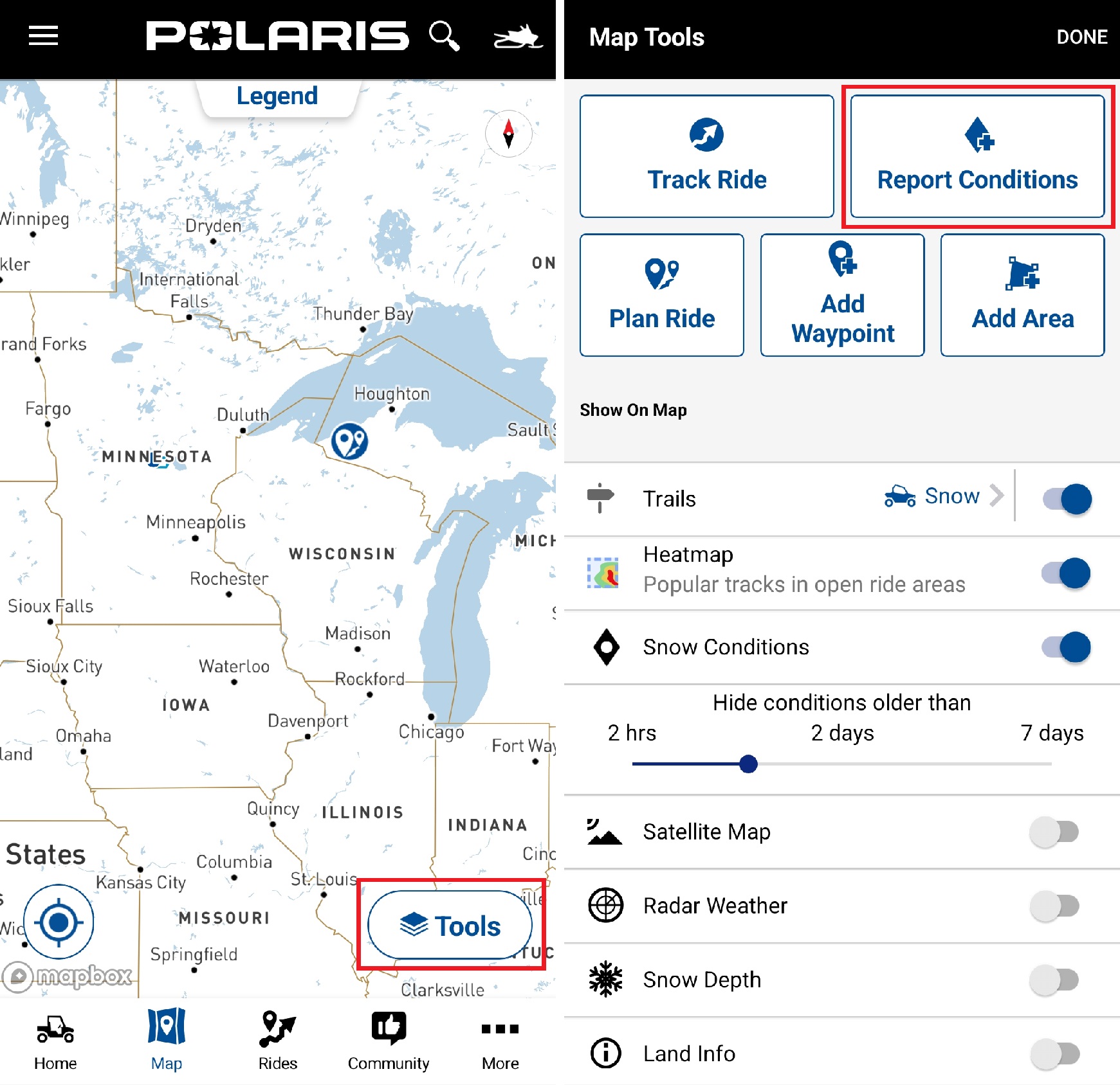
- Trails: toggle Trails layer on or off and switch between Off-Road and Snowmobile trails
- Trail Difficulty (ORV) / Snow Conditions (SNO): information where available (see below to learn how to report snow conditions in the app)
- Heatmap: show popular paths in open ride areas
- Satellite Map: view the satellite map
- Radar Weather: view incoming weather events
- Snow Depth: view the depth of snow in an area (Snowmobile map only)
- Cloud Cover: view cloud layer
- Landowner / County Lines: view public land and county borders
- Tracked Rides, Routes, Places, Areas: your saved items
- Dealers: dealers and what vehicles they service
- Polaris Adventures: vehicle and experience rental outfitters
- Food, Gas, Lodging, Other: waypoints and points of interest provided by Polaris
On the Polaris App, access these options by tapping TOOLS from the Map screen.
Reporting Snow Conditions
On the Polaris App, you can contribute to the Snowmobile map's accuracy by reporting snow conditions.
To report conditions, select TOOLS then REPORT CONDITIONS.
Move the black pin on the map to the location where you would like to report conditions. Select whether the trail was good, okay or bad and leave comments if desired. Click SUBMIT when completed.

Map Orientation
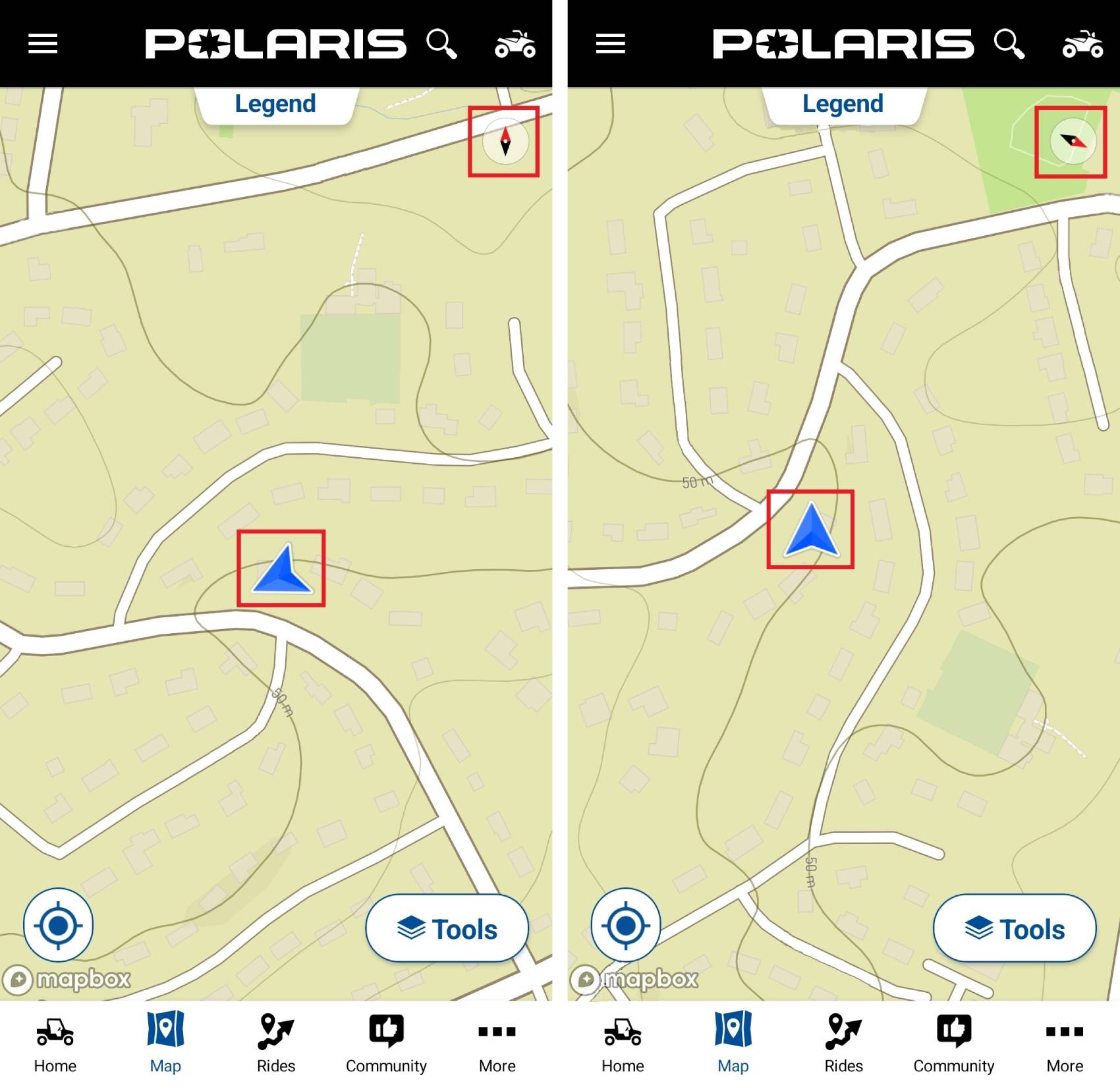
The RIDE COMMAND map can be oriented two ways. To change map orientation, use the navigation button in the right corner of the map page.
North up (left) shows the map with the direction north always facing up. Course up (right) shows the map with your heading facing up, so the screen matches the direction you are traveling.
Downloading Maps
Read Offline Maps on the Polaris App for instructions on downloading a map for offline use.
To browse all RIDE COMMAND articles, read Guide to RIDE COMMAND for Off-Road Vehicles.
The Polaris App is available on the App Store® for iPhone® and iPad®, as well as on Google Play®.
Visit the RIDE COMMAND website for additional information about features, displays and software/map updates.
View the 7" ORV Display User Guide, 7S Display User Guide or 7" ATV Display User Guide.
Google Play® is a registered trademark of Google LLC
App Store®, iPad® and iPhone® are registered trademarks of Apple Inc.
Mapboxsm is a service trademark of Mapbox, Inc.
OpenStreetMapsm is a service trademark of OpenStreetMap Foundation
Unless noted, trademarks are the property of Polaris Industries Inc.
© 2024 Polaris Industries Inc.


